
The Los Angeles County Economic Roundtable maintains a data collection for the Los Angeles Point In Time homelessness counts, as well as data sets for the associated in person surveys. It’s a really remarkable collection, with information both about the locations of the homeless, as well as information about their demographics and health issues. The San Diego Regional Data Library has produced an analysis dataset of the survey data with a few re-coded variables, including Census geoids, that make analysis easier.
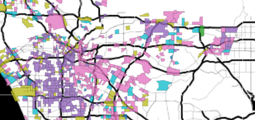
For this example, we will link the survey responses to Census tracts and create a choropleth map colored by the race/ethnicity with the most people of that race/ethnicity surveyed in the tract. Note that this measure is only related to the most common race/ethnicity of the homeless of that tract if the surveyors interviewed people randomly. It’s possible that the interviews focused on a particular demographic, which would skew these results.

Although it is possible that the interviewing was not a random sample, there is evidence that it probably is: the primary cluster of black-predominant responses corresponds with the tracts that have a high portion of Black population. The following map shows the protion of the total tract population that is black, for tracts with more than 10% of the population being black.
